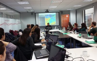
The Seminar “Cropland mapping from free multi-temporal satellite images” was successfully completed
GEOSPATIAL ENABLING TECHNOLOGIES in cooperation with ITC, Faculty of Geo-Information Science and Earth Observation of the University of Twente – Enschede – The Netherlands organized on the 27th, 28th and 29th of November 2017, a three days training seminar regarding...
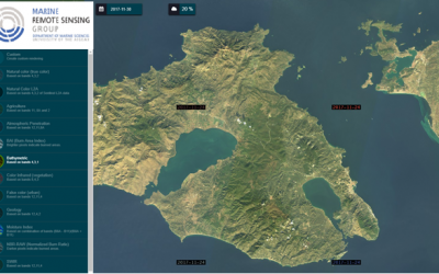
GET cooperates with the Department of Marine Sciences of the University of the Aegean
With the initiative of Marine Remote Sensing Group - MRSG) (http://mrsg.aegean.gr/) of the University of the Aegean, a web geospatial data portal (geoportal) will be developed in order to map marine geophysical parameters. The web portal development software which...
Development of an Integrated Spatial Decision Making and Participatory Planning System
Public Participation in public space planning have partially introduced into Greek legislation (e.g.Sustainable Urban Mobility Plan), however the relative agencies/organization are not yet familiar with this. The need for a different approach of public space planning...
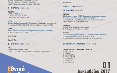
GET supports the event: National Spatial Information Infrastructure: Important tool for national development
The department of Central Macedonia of Technical Chamber of Greece organizes on Friday the 1st of December 2017, event under the title National Spatial Information Infrastructure: Important tool for national development. GET, as an SME with more than 10 years of...
New Projects for GET!
GET starts new projects for Local and Regional Government. More specifically, these projects are: Geo-Informatics applications development for urban planning data management for the Municipality of Maroussi Geospatial data recovery and mapping creation based on the...
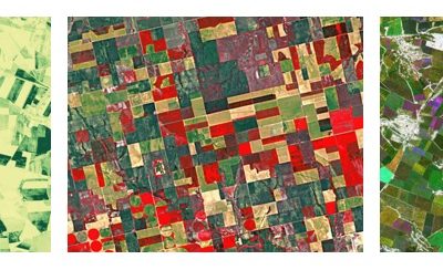
Seminar “Cropland mapping from free multi-temporal satellite images”
GEOSPATIAL ENABLING TECHNOLOGIES in cooperation with ITC, Faculty of Geo-Information Science and Earth Observation of the University of Twente - Enschede - The Netherlands organizing on the 27th, 28th and 29th of November 2017, a three days training seminar regarding...
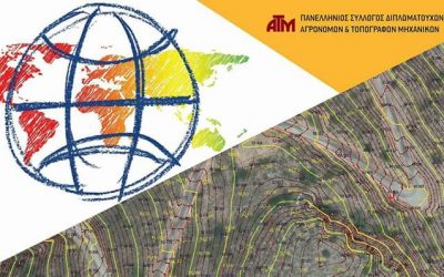
GET at the 5th National Rural and Surveying Engineering Conference
GET participates at the 5th National Hellenic Rural and Surveying Engineering Conference which takes place in Athens on the 14th and 15th of October 2017. GET will be at the exhibition area at Lampadarion Building in Rural and Surveying Engineers Department of...
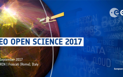
GET will participate at the 3rd EO Open Science 2017 Conference
GET participates in the 3d consultation meeting of EO Open Science in ESRIN (Frascati, Italy) on 25–28 September 2017. The conference is organized by the European Space Agency (ESA) aiming to explore new challenges and opportunities for EO research created by the...
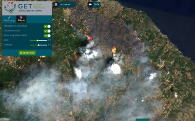
Article at Kathimerini newspaper for the exploitation of satellite data in forest fires.
On the 22nd of August 2017, KATHIMERINI daily newspaper publishes article regarding the exploitation/use of satellite data in forest fires referring also at the solution provided by GET, the platform which give access to almost real time satellite data, GETOpenData....
View, search, download services for Copernicus satellite data via standardized web services for the Municipality of Thessaloniki
Supporting the Municipality of Thessaloniki at the effort to update its infrastructures, GET in cooperation with the Department of building and Urban planning application of the Municipality will upgrade the existing Spatial Data Infrastructure in order to provide to...
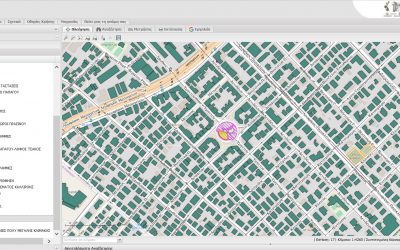
Urban planning data application and open data portal development for Papagou – Cholargos Municipality
GET continues its cooperation with Papagou - Cholargos Municipality and provides its services in order to develop urban planning data application as well as open data portal. The new urban planning data application and the open data portal will be combined with the...
Implementation of the Research proposal Shallow Water Aquatic Monitoring using Acoustic Sensors and Satellite Images (AMOS) under the NEPTUNE Program
GET is funded for the implementation of the research proposal «Shallow Water Aquatic Monitoring using Acoustic Sensors and Satellite Images (AMOS)» under the program "NEPTUNE: New Cross Sectoral Value Chains Creation across Europe Facilitated By Clusters for SMEs’...
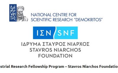
GET participates at the Industrial Research Fellowship program of National Centre for Scientific Research “Demokritos”
GET participates at the Industrial Research Fellowship program of National Centre for Scientific Research “Demokritos” supporting the doctoral research of the PhD candidate Georgia Mavrokefalou for the implementation of the project "Study on the relation of...
SLIPO’s (Scalable Linking & Integration of Big POI Data) leaflet
Under the dissemination and communication activities of the research project SLIPO Scalable Linking & Integration of Big POI Data funded by European Union as part of the Horizon 2020 program, project's leaflet has been designed. You can see the leaflet here. ...
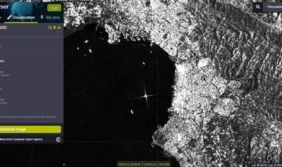
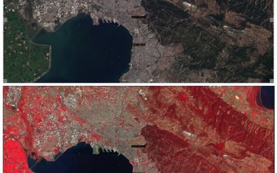
Radar Data, Sentinel-1 SAR (beta release), are also available through GETOpenData Service
SAR data by Sentinel-1 can be used for monitoring ice areas, oil spills, sea winds and currents, changes in land use, earth movements, so they are really useful for evaluating natural disasters such as floods and earthquakes. These data, until recently, they were not...
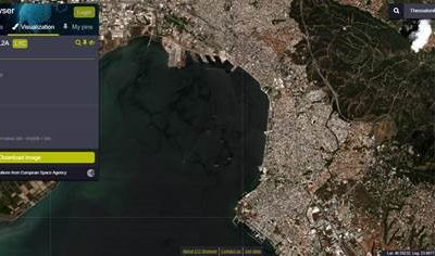
New model for atmospheric correction (Sen2Cor) for Sentinel-2 data through GETOpenData
GET Open Data Service, which provides access to Sentinel HUB data, gives also access to new data which can be found an used through the service and these are Sentinel-2 L2A data. They concern Sentien-2 data with atmospheric correction with Sen2Cor algorithm and...
Special Secretariat for Water offers geospatial datasets through Geoportal
Under the creation process of Management Plans, geospatial datasets are produced. These data concern the determination of Water Districts, River Basins, and underground and surface water systems. The Special Secretariat for Water offers geospatial datasets through...
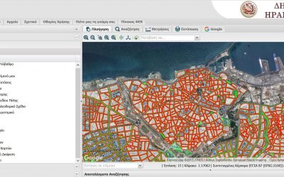
Expanding the SDI of the Municipality of Herakleion
The modern Spatial Data Infrastructure of the Municipality of Herakleion has already received many positive comments by its users, the number of whom is over 1.000 per month. Based on the statistical analysis of users' responses, a large percentage of users uses the...

GET participated successfully at the 4th Technology Forum (www.technology-forum.eu)
As part of the financial environment nowadays, in which all the organizations must be competitive, it is very important to produce innovative products with international appeal. For the process of producing innovative products, the contribution of productive parts (IT...
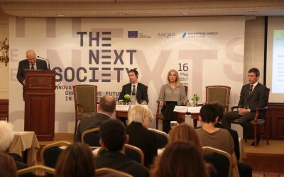
GET among the 30 innovative organizations from 15 European and Mediterranean countries participating at the Enterprise Greece conference
The Organization Enterprise Greece and ΑΝΙΜΑ Investment Network,under the support of EU4Innovation, co-organized the innovation conference "The Next Society" in Athens on the 16th of May. The conference opened with Christos Staikos, Chairman of Enterprise Greece and...