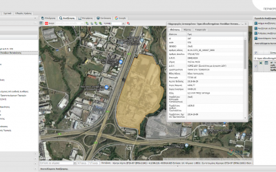
GIS for the manufacturing activity of the Central Macedonia Region
GET, in cooperation with the AKKT Engineering Consultants, completed successfully the project about the design and development of the Geographic Information System for the manufacturing activity in the region of Central Macedonia, under the contract of 12-10-2017...
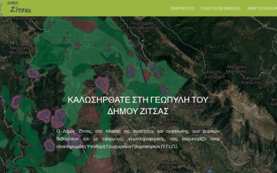
Zitsa’s Spatial Data Infrastructure is on air
The Municipality of Zitsa has developed a Spatial Data Infrastructure, driven by the transition to a digital administration system, the development of added value services and the improvement of public services. A set of functions, that facilitate gathering of the...
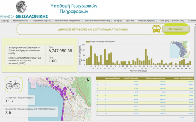
Municipality of Thessaloniki: GeoKPIs
GET in cooperation with the Municipality of Thessaloniki under the framework of «Implementation of information and interaction units – Geospatial Indicators of Performance» project, successfully completed the development of a new urban governance model, based on...
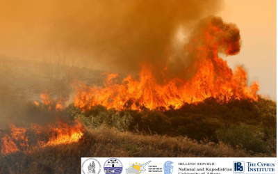
LIFE ASTI 1st Technical & Monitoring meeting
The LIFE ASTI 1st Technical & Monitoring meeting took place in Rome, on March 7th-8th. The Partners had the opportunity to review the Project's progress and plan the next steps with a strong focus on: preparatory actions, implementation of forecasting and heat...
Implementation of Climate Change Projects in collaboration with the Department of Environmental Science and Technology of the Department of Chemical Engineering of the National Technical University of Athens
GET, with significant experience in enviromatic and geoinformatic projects, took part the implementation of two important LIFE projects focusing on tackling climate change. Specifically, GET participates in the development of specialized web tools in the framework of...
Air pollution and particulate matters measurements application
GET in cooperation with the University of Patras under the framework of THERMI-AIR project, conducted for the municipality of Thermi, implements a web application and an Android one as well, that presents air pollution and particulate matters measurements. Users will...
LIFE ASTI’s website on air
The website https://lifeasti.eu/ is ready! It was created for the project “Implementation of a ForecAsting System for urban heaT Island effect for the development of urban adaptation strategies - LIFE ASTI” under the “LIFE 2014- 2020” for the “Climate Action”...
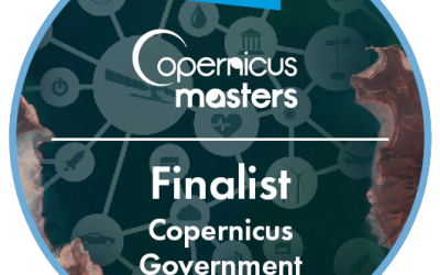
GET participates at Copernicus Accelerator as one of Copernicus Masters’ competition finalists
GET for the next year will be among the companies which will be supported by the Copernicus Accelerator Program. The program offers a customized business development scheme to visionary start-ups and entrepreneurs working in the EO sector. The above achievement has...
Municipality of Thessaloniki and GET’s solution at the publication of E.C., ESA and NEREUS
The European Commission, the European Space Agency and the network of European regions using space Technologies (NEREUS) issued a magazine on the continuously increasing use of satellite data of the Copernicus system in the regions and municipalities of Europe . The...
GET cooperated with the National Observatory of Athens
GET implements the website and the Early Warming System following the bid/tender process of the National Observatory of Athens. The project is implemented under the framework of the project “DISARM”: «Drought and fΙre ObServatory and eArly waRning systeΜ» του...

SLIPO Workbench: POI integration made simple
The SLIPO Workbench offers advanced capabilities for transformation, interlinking, fusion, enrichment, and analytics from multiple, large datasets for Points of Interest (POIs). The Workbench allows users to design custom data integration workflows, schedule their...
GET cooperates with Institute of Communication and Computer Systems
GET cooperates with the Institute of Communication and Computer Systems of National Technical University of Athens providing subscription access service through API (search, view, download) in Copernicus system satellite data, under the framework of the Horizon 2020...
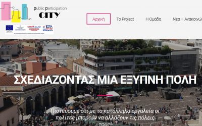
Deliverables of the first semester of the ppCity project are launched!
Deliverables, of the first semester of the project "Integrated System for the Spatial Decision Support and Participation Planning (ppCity, project code T1ΕΔΚ-02901) which is co-financed by the European Union and the European Regional Development Fund under the...
GET participates at the 10th National HellasGIs Conference
GET participates at the 10th National HellasGIs Conference which takes place, with the completion of 20 years of HellasGIs foundation and GIS Day 2018, at the National Technical University of Athens, Administration Building, Zografou area, on the 12th, 13th and 14th...
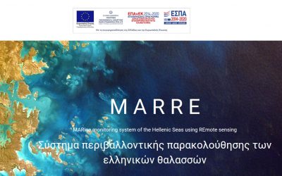
MARRE (Τ1ΕΔΚ-02966) website
The website http://marre.gr/ for the project MARine monitoring system of the Hellenic Seas using REmote sensing satellite data and in-situ measurements (MARRE – Project title: Τ1ΕΔΚ-02966), co-financed by the European Union and the European Regional Development Fund...
GET participates at LIFE ASTI
Η GEOSPATIAL ENABLING TECHNOLOGIES συμμετέχει στην υλοποίηση του έργου “Implementation of a forecAsting System for urban heaT Island effect for the development of urban adaptation strategies – LIFE ASTI” (Εφαρμογή συστήματος πρόβλεψης του φαινομένου της Αστικής...
MOU between SOAR – SINERGISE – GET
Having as a goal to provide innovative mapping services, SOAR, a start-up Australian company, signed MOU with Sinergise and GEOSPATIAL ENABLING TECHNOLOGIES. Read here the relative press release.

New projects under the frame of RESEARCH – CREATE – INNOVATE action
GET participates at the implementation of new research projects under the framework “RESEARCH – CREATE – INNOVATE” of the Operational Programme “Competitiveness Entrepreneurship Innovation” (EPAnEK 2014-2020), Partnership Agreement 2014-2020. The projects which are...
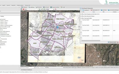
Free access to urban planning data for the Municipality of Maroussi
Municipality of Maroussi makes one more step towards innovation, regarding city urban planning data, entering into a new digital era. Exploiting technology, up=to-date interoperability tools as well as technical knowledge of human resources, city plan is digitized,...
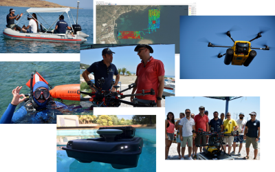
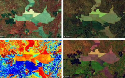
Pilot of the AMOS project “Shallow Water Aquatic Monitoring using Acoustic Sensors and Satellite Images”
Geospatial Enabling Technologies (GET) in cooperation with the French SME SEMANTIC TS successfully completed between 5 and 10 of July in Lesvos island the pilot of the AMOS project "Shallow Water Aquatic Monitoring using Acoustic Sensors and Satellite Images" which is...