
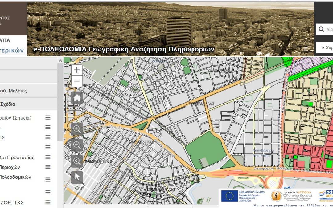
GET in Electronic Urban Planning Project
GET, as subcontractor of INTRASOFT INTERNATIONAL S.A. and TERRA MAPPING THE GLOBE, undertook and completed for the project “ELECTRONIC URBAN PLANNING: GEOGRAPHIC INFORMATION SYSTEMS FOR PREFECTURAL AUTHORITIES OF THE COUNTRY” the development of application...
Spatial Data Infrastructure for the Municipality of Agia Paraskevi
GET begins cooperation with the Municipality of Agia Paraskevi for the development of a Spatial Data Infrastructure. The objectives of the project are: development of Spatial Data Infrastructure for the Municipality of Agia Paraskevi through customized data design,...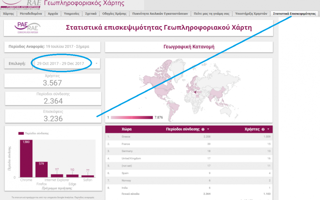
Published number of visits for the Regulatory Authority of Energy GeoPortal
The very important project of the Regulatory Authority of Energy is reflected in recent published features regarding number of visits in the web page of the relative application (www.rae.gr/geo/). We believe that these data are a very reliable way which presents the...
GET cooperates with the Department of Marine Sciences of the University of the Aegean
With the initiative of Marine Remote Sensing Group – MRSG) (http://mrsg.aegean.gr/) of the University of the Aegean, a web geospatial data portal (geoportal) will be developed in order to map marine geophysical parameters. The web portal development software...