Sep 3, 2018 | Data as a Service, Press Releases
Having as a goal to provide innovative mapping services, SOAR, a start-up Australian company, signed MOU with Sinergise and GEOSPATIAL ENABLING TECHNOLOGIES. Read here the relative press release.
Jul 26, 2018 | Press Releases, Projects
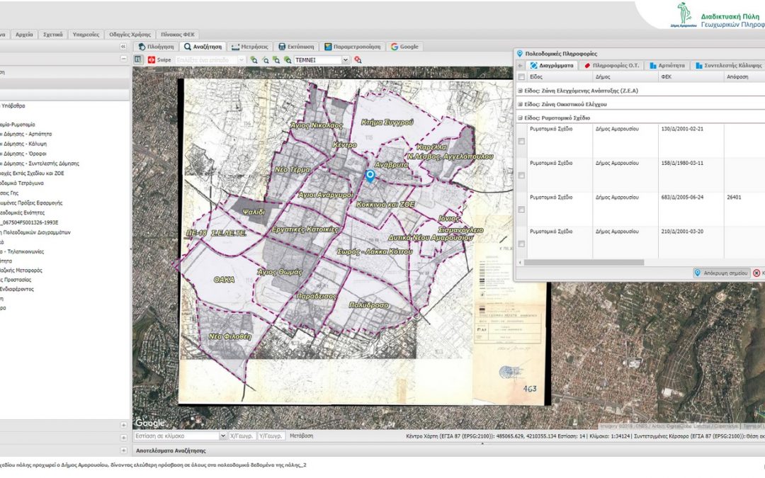
Municipality of Maroussi makes one more step towards innovation, regarding city urban planning data, entering into a new digital era. Exploiting technology, up=to-date interoperability tools as well as technical knowledge of human resources, city plan is digitized,...
Jul 23, 2018 | Press Releases, Technology
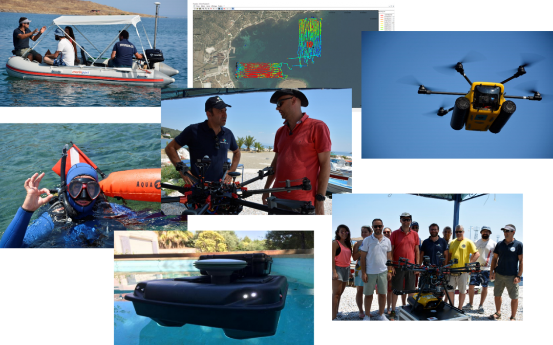
Geospatial Enabling Technologies (GET) in cooperation with the French SME SEMANTIC TS successfully completed between 5 and 10 of July in Lesvos island the pilot of the AMOS project “Shallow Water Aquatic Monitoring using Acoustic Sensors and Satellite...

May 15, 2018 | Press Releases
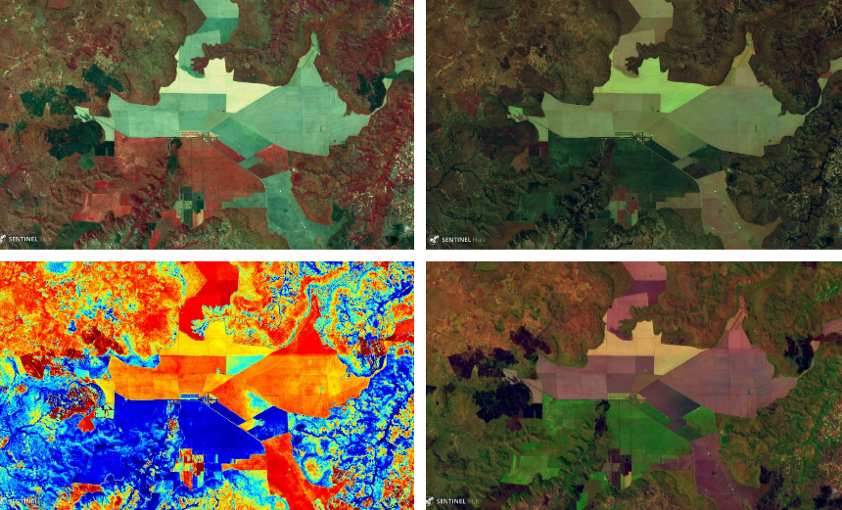
Exploiting a huge volume of free available Copernicus System Sentinel-2 satellite data, being collected daily, can be easily and effectively only with the use of artificial intelligence. This is what our partnership with Simulirity provides to us, through...
May 7, 2018 | Press Releases, Technology
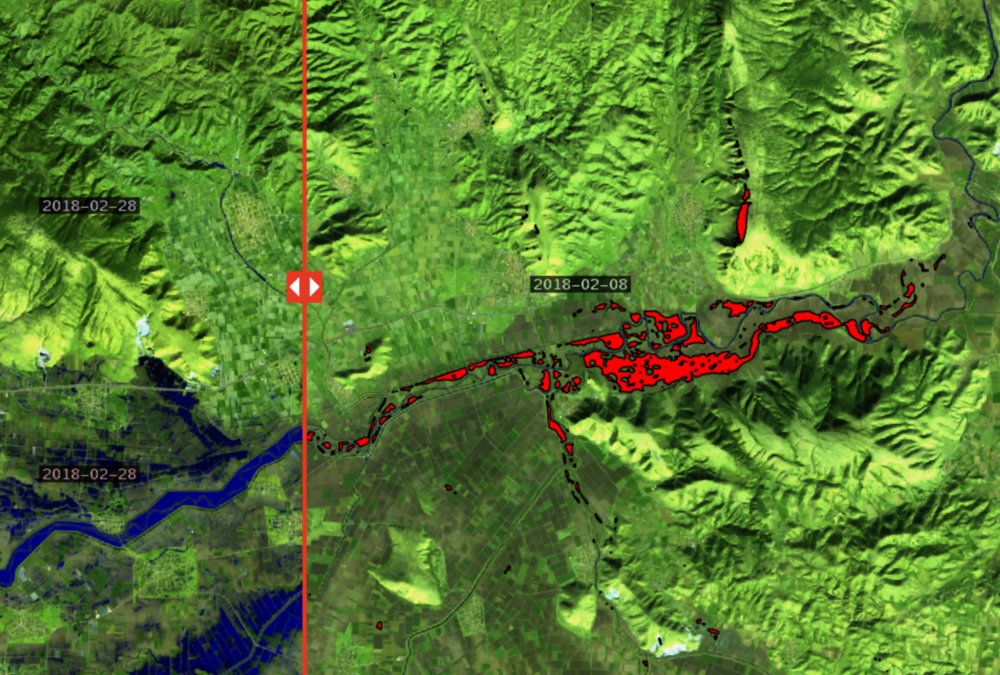
The web portal Prevention web publishes article regarding the use of satellite imagery for crisis management after floods with detailed reference to the solution provided by GET in the case of floods in Farkadona at region of Thessaly last February. The article has...

Apr 12, 2018 | Data as a Service, Press Releases
In the last couple of years we have experienced record-breaking extreme weather. In terms of lives lost and property damaged, floods are among the most devastating natural disasters. To assess the damages experts use different approaches, among which the use of...