
Sep 30, 2020 | Press Releases, Projects, Έργα
GET successfully continues the development of projects in the field of Local Government, implementing Spatial Data Infrastructures (SDI), in accordance with the INSPIRE Directive, for the supply of “vertical” Urban Planning applications. The Municipality...

Sep 30, 2020 | Press Releases, Projects, Έργα
The Energy Regulatory Authority (RAE) in collaboration with Geospatial Enabling Technologies (GET) have developed a System of Spatial Control of Applications (SCA) for the issuance of electricity generation licenses from Renewable Energy Sources (RES) and Electricity...
Jul 29, 2020 | Projects, Έργα
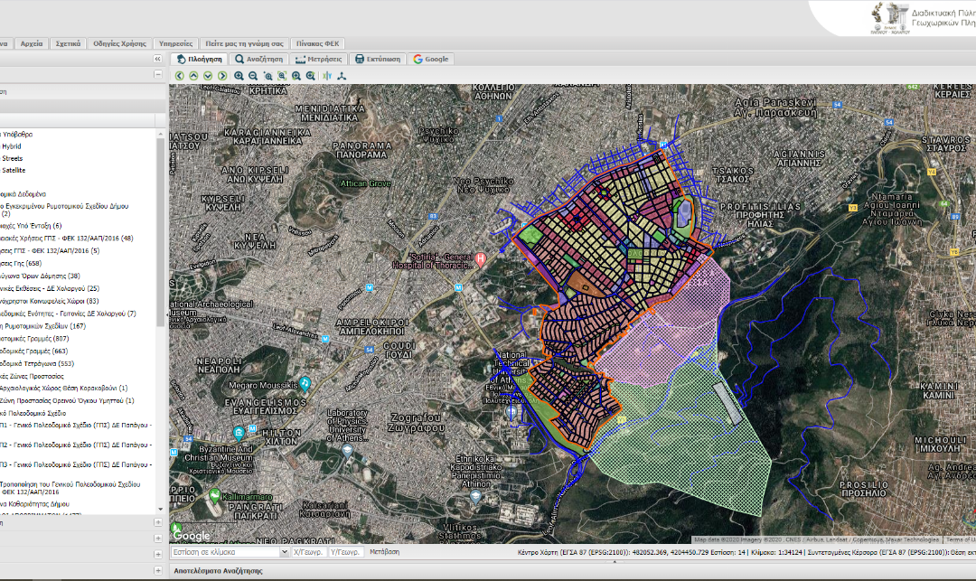
GET continues successfully the development of projects for Local Government authorities, aiming at the supply of “vertical” added value applications, exploiting and expanding the Spatial Data Infrastructures developed in previous projects. Municipalities...
Jul 29, 2020 | Projects, Έργα
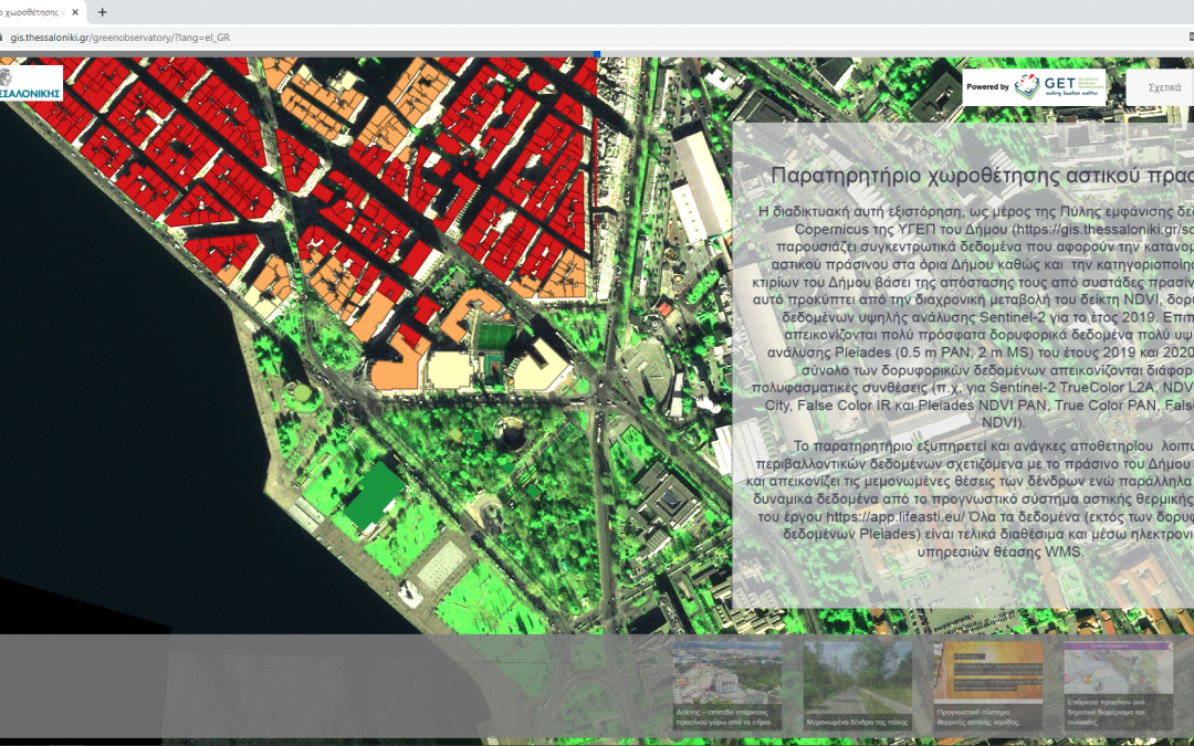
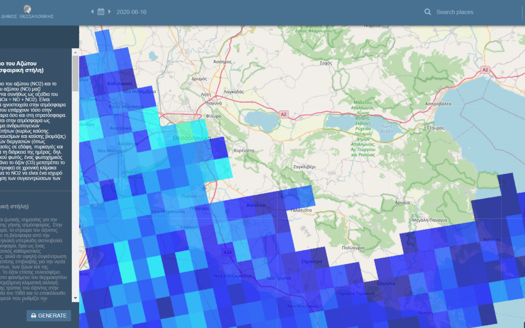
In order to utilize data and information, which are provided to the Municipality of Thessaloniki via the COPERNICUS satellite imagery service, GET developed the “Observatory of Urban Green Siting” for the Municipality (https://sdi.thessaloniki.gr/greenobservatory...
Jul 29, 2020 | Corporate Social Responsibility, Projects, Έργα
Creation of Geospatial Information Infrastructure in Oinousses Under the Corporate Social Responsibility framework of actions https://lnkd.in/ecGu9U5, which are systematically undertaken by our company, we decided to start a three-year program during which we will...
Jun 24, 2020 | Data as a Service, Press Releases, Projects, Δεδομένα ως υπηρεσία, Έργα
Copernicus (http://www.copernicus.eu) is the world’s largest open source data sharing program. Its goal is to provide continuous, reliable and free satellite Earth Observation (EO) data, with global coverage. Recognizing its metropolitan role, the Municipality...