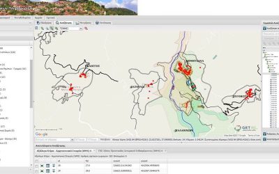
GET’s presentations at the 2nd GIS and Spatial Analysis in Agriculture and Environment Conference
GET participated with success at the 2nd GIS and Spatial Analysis in Agriculture and Environment Conference, which took place at the conference area of the Agricultural University of Athens on the 25th and 26th of May 2017, with the presentations: 1. GETOpenDAΤΑ:...
GET participates at the Safe Athens 2017 Conference
GET will be sponsor at the conference Safe Athens 2017: New technologies under Civil Protection service. The conference will take place on the 28th to 30th June 2017 at the Harokopeion University in Athens. You will find GET's team during the conference at the...
GET supports the event “Global Day for the Environemt 2017” organized by Physics Department of Aristotle University of Thessaloniki
GET supports, as a sponsor, the event "Global Day for the Environment 2017" organized by the department of Physics (Postgraduate program Environmental Physics) of Aristotle University of Thessaloniki, taking place on the 8th of June in Building of Physics, School of...
GET at the Smart and blue city Conference
GET participates with the paper Spatial Data Infrastructure For Urban Planning: The Case Of Heraklion at the Euro - Mediterranean Conference Smart and blue city which will take place at Heraklion Crete, on the 28th and 29th of September 2017. The Euro-Mediterranean...

GET supports Smart Islands Initiative
GET supports Smart Islands Initiative. The Smart Islands Initiative is a bottom-up effort of island authorities and communities. It builds on years of collaboration between EU islands and seeks to convey the significant potential of islands to function as laboratories...
Presentation at the 2nd GIS and Spatial Analysis in Agriculture and Environment Conference
GET will participate at the 2nd GIS and Spatial Analysis in Agriculture and Environment Conference,which will take place at the conference area of the Agricultural University of Athens on the 25th and 26th of May 2017, with the presentations: 1. GETOpenDAΤΑ:...

GET supports FabSpace HackOnEarth
GET supported FabSpace HackOnEarth by offering access to Sentinel Data through the Sentinel HUB API (https://lnkd.in/gmiVnxm). Every registered to the event user could add as many unique-named instances as he/she chose. An instance acted as a separate WMS/WMTS/WFS/WCS...

GET becomes a member of the Northern Greece Informatics Enterprises Association
GET became member of Northern Greece Informatics Enterprises Association. Having already significant presence in Northern Greece via implemented projects, e.g. Spatial Data Infrastructure for the Municipality of Thessaloniki, as well as via its cooperation with other...
Continuing the enrichment of Spatial Data Infrastructure of Municipality of Gortynia with data and applications
Municipality of Gortynia is the first Municipality in the country invested in the combinatorial solution of Spatial Data Infrastructure and Open Data Portal actually implementing the national laws 3882/10 and 4305/2015. The SDI is a live mechanism that requires...
Touristic applications development for the Project NETCASTLE
GET, as subcontractor of DOTSOFT, participated at the project “Touristic content collection, digitization and applications development for NETCASTLE Network creation and promotion of castles)“, developing Geographic Information Systems applications. The project, which...
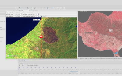
Sentinel-3 data services integrated into GETOpenData
We are quite pleased to announce the integration of Sentinel-3 mission data. Geospatial Enabling Technologies Ltd. (GET) as the unique Greek partner of Sinergise Ltd, continues to develop the concept of Sentinel Hub and successfully incorporates the newly launched...
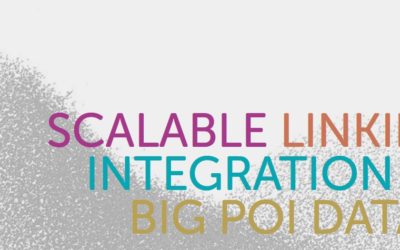
New R&D project for GET under Horizon 2020 framework
GET participates at the new Research project SLIPO: Scalable Linking & Integration of Big POI Data under the Horizon 2020 frame. Partners for the implementation of the project are : Institute for the Management of Information Systems (part of Athena Research and...
GET completes project for Hellenic Center for Marine Research
GET cooperates with the Hellenic Center for Marine Research for the production of the software required for the Research Program Emodnet “Ingestion And Safe –Keeping Of Marine Data”. GET has completed the work regarding the development of the parts of a Portal for...
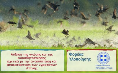
GET completed the project for Attica Region
GET completed successfully the Subproject 6: “Awareness raising, information and communication" as part of the Action " Knowledge and awareness increase about the restoration and rehabilitation of wetlands in Attica" for Attica Region. For the project GET implemented...
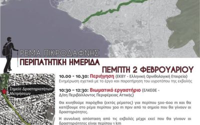
Second Day Conference for Attica Region Project
The second day conference under the Action “ Knowledge and awareness increase about the restoration and rehabilitation of wetlands in Attica – Subproject 6: “Awareness raising, information and communication” will take place om Thursday the 2nd of February. The...
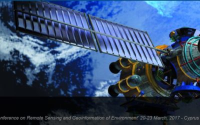
GET will be at the Fifth International Conference on Remote Sensing and Geoinformation of Environmentʼ 20-23 March, 2017 – Cyprus
GET will participate at the RSCy2017, the Fifth International Conference on Remote Sensing and Geoinformation of Environment" which takes place on 20th to 23rd of March 2017 in Paphos, Cyprus. GET will be at the conference area, ready to inform about its solutions...

GET partners with Sinergise to offer added value services based on Copernicus data in Greece and Cyprus
Sinergise Ltd., a GIS company building advanced solutions for management of spatial data announced a new reseller partnership with Geospatial Enabling Technologies Ltd. (GET). As part of this alliance, GET, GeoInformatics solutions provider based on open standards,...
Leveraging Municipality of Thessaloniki open data
GET, as it is mentioned in our company website has as a goal to maximize the added-value provided by geospatial information. We achieve this by supporting open knowledge, open software, open standards and open data. There is no greater reward for us than to see that...
Spatial Data Infrastructure for Chania Municipality
GET in cooperation with the Municipality of Chania begins the work regarding the development of Spatial Data Infrastructure in order to use and manage in the best way the existing digital geospatial data of all the Departments of Chania Municipality for facilitating...
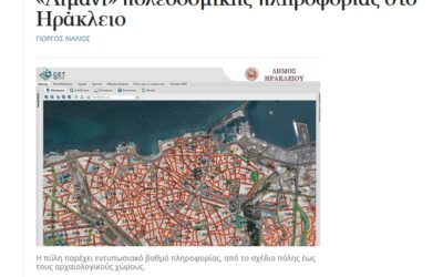
Press release from KATHIMERINI for Heraklion Municipality
With the title "Port" of urban planning information at Heraklion, Mr Liolios from KATHIMERINI press, accurately refers to the geospatial information web portal developed by GET in cooperation to the Urban Planning Department of Heralion Municipality. As it is referred...