Archaeological Data Management Infrastructure
PROFILE
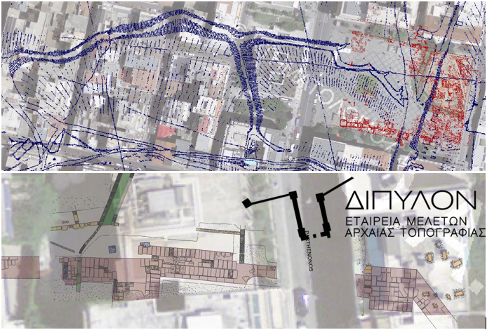
Name: Dipylon
Dipylon is a nonprofit organisation (NPO) for the study of the ancient topography and the cultural environment through interdisciplinary research on Archaeology, History, Informatics and Cartography. It focuses on the collection, organisation and dissemination of published archaeological material, archival evidence and cartographic data, using digital technology to enhance the available cultural resources, in cooperation with the competent bodies. The study of the topography of ancient Athens is at the center of the effort, with the goal of expanding the relevant research to further case studies in Greece.
Website: https://dipylon.org/gr/archiki/
The purpose of the project was to develop an infrastructure for the collection, management and processing of archaeological material and cartographic data.
The solution developed by GET offers state-of-the-art tools that support the company’s functions that relate to the management of the geospatial data, offering improved technologies, workflow automation and resource savings.
To be more specific, the solution consists of two (2) modules:
1. Central Spatial Database (DB). The following specifications have been considered:
- spatiotemporal changes in archaeological objects.
- the need for queries with temporal, spatial, descriptive criteria and a combination of them.
- the creation of automated triggers, stored procedures for performing repetitive routines.
- the digital geo-referenced data import as background.
- new data import from future work.
- Open geospatial data import from other sources
- The definition of user roles according to the company’s business requirements
2. Desktop GIS applications. Including:
- the installation and configuration of the Desktop QGIS applications
- the development of standardized workflows for data entry into a single geographic database. Workflows ensure that data is correctly recorded (e.g., using drop-down lists to avoid registration errors).
- the formulation of management tasks of a single geographical database.
- the development of reusable cartographic symbols and the creation of new ones, in collaboration with DIPYLON executives.
Support services have been provided to DIPYLON.
Overall, the two modules form an integral part of the project platform, which:
- will support the advanced information search at the level of discrete archaeological remains on a digital map, based on type and date (eg Hellenistic houses or Roman baths).
- will include a reference to primary published and archival sources.
- will support spatial and chronological data combination.
The study covers an area of 5,900 acres in and out of the ancient wall of Athens. It is estimated that data from at least 1,500 archaeological sites will be incorporated.
TECHNOLOGY
- PostgreSQL / TimescaleDB
- Quantum GIS